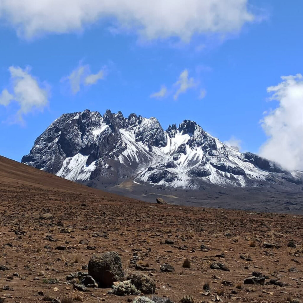
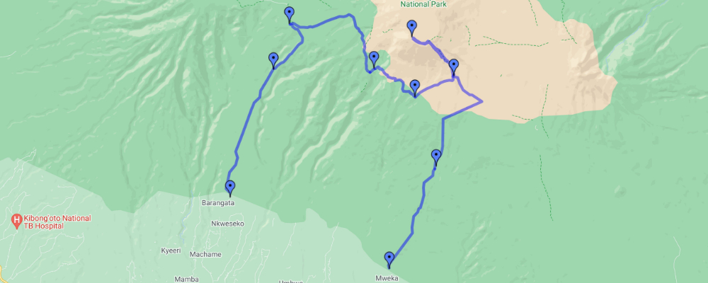
This route is also known as the “Whiskey” route due to the fact that it is considered somewhat expensive and a bit more challenging than the Marangu route. The route is Also it is considered to be a good route for acclimatization as it exposed the climber with higher elevation quicker which gives the kickstart to the body adaptation to the altitudes. In this, the climbers accommodating in camps, and the ascending route and the descending route is different when on descending the trekkers using the Mweka route, this gives a chance to the climbers to see beautiful sites on the mountain from different sides such as Lava Tower, Barranco wall. But this route is considered as difficult with very steep sections along the way which is physically demanding more than the Marangu route and it is better suited for more adventurous climbers with some hiking experiences.
| INCLUSIONS |
|
||||||||||
| EXCLUSIONS |
|
Day 0 : Breafing Day
If you just arrived in Kilimanjaro airport one day or more before the trek and you choose to use transfer service, we will pick you up from the airport directly to your accommodation in Arusha/Moshi.
A day before the hike used for briefing about the whole trek. Checking of the equipments and everything regarding the hike, Meeting with the Head guide to answer all of your questions etc. so it is advised to arrive at least one day before the hike for all the arrangments etc
Day 1 : From Machame Gate To Machame Camp
After breakfast from your hotel in Arusha/Moshi start driving to the Machame gate. From Arusha it takes around 2.5-3 hours and from Moshi to the Machame gate is approximately 45 minutes to 1 hour. Reaching the gate, the guide will do registration and after everything is arranged you will start the hike. You will walk through the rain forest on a winding trail up a ridge. At the lower part the trail can be muddy and slippery what makes gatters and trekking necessary and mostly useful. Later on arriving at Machame camp for dinner and overnight.
Elevation: 1,830m/6000ft at Machame gate to 2,835m/9,300ft at Machame camp.
Walking distance: 11kms/6.8 miles
Estimate walking time: 5- 7 hours
Habitat: Rain forest and Moorland
Day 2 : Machame Camp To Shira Camp
After breakfast you leave from the rain forest and continue ascending , crossing the valley along a steep rocky ridge, the route turns west into the river gorge, you will arrive at the Shira camp for relaxing, dinner and overnight.
Elevation: 2,835m/9,300ft at Machame camp to 3,610m/11,843ft at Shira camp
Walking distance: 5kms/3 miles
Estimate walking time: 4-6 hours
Habitat: Moorland
Day 3 : Shira Camp To Lava Tower Camp To Baranco Camp
From the Shira camp plateu you continue ascending through the east up ridge passing the junction toward the peak of Kibo. As you ascend more the direction changes to the south east towards the Lava Tower nicknamed “the sharks tooth” the shortly after the tower you get to the second junction which bring you to the arrow glacier at an altitude of 4,877m/16,000ft and then you continue down to the Baranco camp at an altitude of 3,900m/12,795ft for resting, dinner and overnight.
Elevation: 3,610m/11,843ft at Shira camp, 4,600m/15,092ft at Lava tower and 3,900m/12,795ft at Baranco camp
Walking Distance: 10kms/6.2 miles
Estimate walking time: 6-8 hours
Habitat: Semi desert
Day 4 : Baranco Camp To Karanga Camp
After breakfast you will leave Baranco camp, keep on ascending on the steep ridge through Baranco wall, approximately it takes around 1 hour to climb the wall and you may need to use your hands occasionally but don’t be over concerned as the wall is not dangerous. At the summit of the wall the road drifts and leads you to the Karanga valley camp. You will rest, dinner and overnight at Karanga camp.
Elevation: 3,900m/12,795ft at Baranco camp, 3,995m/13,106ft at Karanga camp.
Walking distance: 6kms/ 3.7 miles
Estimate walking time: 5-6 hours.
Habitat: Moorland and Alpine desert
Day 5 : Karanga Camp To Barafu Camp
After breakfast, continuing to ascend and on the way you hit the junction which connects with Mweka trail. You continue ascending to Barafu camp. At this point you will may be able to see the summit of Uhuru peak from different angles. You will rest at Barafu camp, eat dinner and prepare for summit hike.
Elevation: 3,995m/13,106ft at Karanga to 4,673m/ 15,331ft at Barafu camp.
Walking distance: 4kms/ 2.48 miles
Estimate walking time: 3-4 hours.
Habitat: Moorland and Alpine desert
Day 6 : Barafu Camp To Summit To Mweka Camp
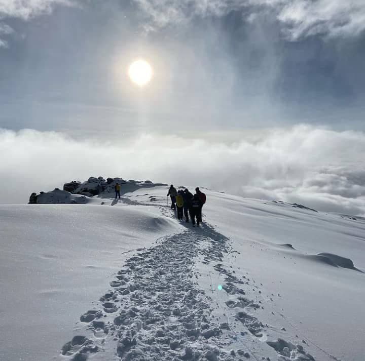
Wake up very early in the morning (midnight to 2am) and continue ascending to the summit, on the way you will reach Stella point at 5,745m on the edge of Kibo crater. The trail is steep and slow, from Stella point to Uhuru peak it takes around 45 minutes, passing through glaciers and snowfields. And then you will arrive at the highest point of Africa, Uhuru peak at 5895m! After resting, taking some pictures you start descending back down to Barafu camp, eat breakfast and relax a bit before continue descending all the way to Mweka camp, where you can take a rest, eat dinner and overnight at Mweka camp.
Elevation: 4,673m/ 15,331ft at Barafu camp, Uhuru point at 5,895m/ 19,340ft and 3,100m/10,170ft at Mweka camp
Walking distance: 5km/3 miles ascending and 12km/7.5 miles descending
Estimate walking time: 7- 8 hours ascending and 4-6 descending
Habitat: Arctic at the summit, alpine desert and moorland on the way down
Day 7 : Mweka Camp To Mweka Gate To Moshi/arusha
After breakfast at Mweka camp you continue descending all the way to Mweka gate where you will receive your certificate if you manage to reach Stella point and Uhuru point. From the gate, the transfer car will pick you up to take you back to your accommodation in Arusha/Moshi.
Walking distance: 10km/6.2 miles
Estimate walking time: 3-4 hours


Tour Reviews
There are no reviews yet.
Leave a Review